The Alaska Highway from Whitehorse to Beaver Creek, Yukon

[Yukon]

Corduroy again today. Road still in bad shape after recent rains. Slowly this mud hole is resembling a road. (Soldier’s diary, August 24, 1942)

It may have been President Herbert Hoover’s dream in 1930
to build an overland link from Alaska to the continental United States,
but it wasn’t until the Japanese bombed Pearl Harbor in 1941
that it was deemed a military necessity to do so.
The construction of the Alaska Highway
was authorized by President Roosevelt on February 11, 1942,
and within a month, the right of way was approved
by the Canadian government.
The U.S. would pay for the construction of the highway
and turn over the portion in Canada to the Canadian government
when the war ended.
In the best of times,
it would be an ambitious goal
to build a 1,525-mile road from Dawson Creek, British Columbia,
to Fairbanks, Alaska through the three M’s –
muskeg, mountains, and mosquitoes –
but to literally carve this road out of the wilderness
in only eight months was staggering.
It took 11,000 American troops
and 16,000 civilians from the U.S. and Canada,
laying down eight miles of road every day,
seven days per week,
suffering from hypothermia,
fatigue,
and injuries,
to complete the task.
Incredible, really,
when you think about it.

Bitter cold. Canteens frozen and diesel fuel like soft lard. (Soldier’s diary)

Finally, in a ribbon-cutting ceremony
performed in -35-degree weather,
and in the presence of 250 soldiers, civilians,
and Royal Canadian Mounted Policemen,
U.S. and Canadian officials opened the road.
Today’s highway doesn’t look anything
like the highway that was built in 1942.
That highway had 25-degree grades in some spots,
which just wouldn’t do in a post-war environment.
Since 1964, the Canadian Department of Public Works
has been improving the worst parts of the highway each year.
Today, it is an all-weather, hard-surfaced
(except in spots where there is construction) highway,
suitable for drivers like myself,
who don’t like to drive through the muck.

The home of Mount Logan, Canada’s highest mountain.  Mount Logan cannot be seen from the highway, though – it’s simply too remote.  The mountains you see from the highway are pretty high, over 2,000 meters, but consider that Mount Logan is 2.5 times higher than that.  Wow!
At Haines Junction, pick up a copy of “Things to see and do on the way to Beaver Creek, Yukon Territory” from the Information Centre.  Also, the coffee and pastries at the Village Bakery were awesome! 
The mountains you will see along the way.
And more mountains.
After consulting my trusty “Common Yukon Roadside Flowers” wildlife viewing guide, I can confidently say that this is a Narrow-Leafed Arnica, part of the sunflower family. 
And I believe this is Arctic Lupine, part of the pea family.
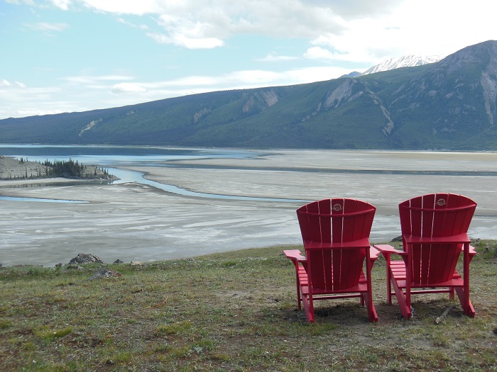
Kluane Lake, from Soldier’s Summit.  Kluane Lake is interesting because about 3000-4000 years ago, it had a complete reversal in its water flow after the Kaskawulsh Glacier advanced across Slims River and closed Kluane Lake’s drainage outlet.  The water subsequently rose 10 meters and a new outlet was formed.  Instead of the water travelling 225 kilometers south to the Pacific Ocean, it now connects to the Yukon River and travels 10 times further north to the Bering Strait.  
Although wildlife was not abundant on this stretch of the Alaska Highway, I was fortunate to have some time alone with a Grizzly. 
The inevitable construction to improve the highway.
Following the Pilot Car.  (I wonder if it knows it’s a pickup truck.)
A view of Kluane Lake from the top of Soldier’s Summit, and the end of a short, scenic, interpretive walking trail.  Well worth stopping for and stretching the legs.
And finally, Beaver Creek, population 103, although the woman at the Information Centre said someone was pregnant in town.  I can now say that I’ve travelled to Canada’s westernmost community.  Woohoo!  A coffee and a pastry and I head back to Whitehorse.

Leave a Reply

Your email address will not be published. Required fields are marked *