I take a break on a low rocky ledge beside the highway and spend twenty minutes watching some ants go about their business.
I don’t think I’ve seen ants like this before, with red bodies and black abdomens.
Spiders are scattered about, waiting patiently on their webs for their prey to arrive.
I can see an old web with a dead ant on it, so there is some drama as the ants wander close to the webs.
I watch a biting fly buzz around and am hoping to see him fly into a web, but instead he lands on me.
And as he is about to take a bite out of my leg, I swat him dead.
Like the spider, I can also wait patiently.
In the end, I leave without seeing any of the spiders catch a thing.
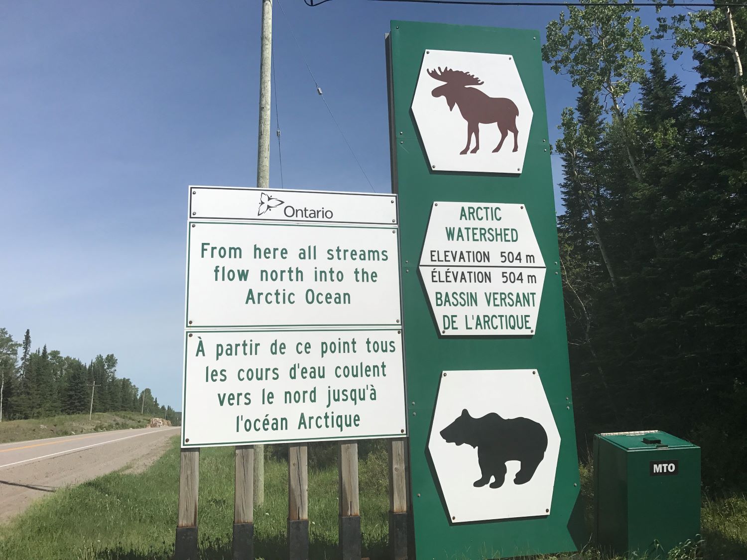
Before noon, I pass into the Arctic Watershed.
From this line, at a location on the highway of 504 meters elevation, all flowing water eventually reaches Hudson Bay.
This was considered the southern boundary of Rupert’s Land, the territory controlled by the Hudson’s Bay Company until 1870.
In 1883-1884, this boundary also figured prominently in the Ontario-Manitoba boundary dispute.
Apparently, entering into the Arctic Watershed also means I cross into deer fly and horse fly territory.
I fight them for a steady hour, receiving two good bites, but killing a dozen deer flies.
I can’t get any horse flies though; they’re too wily.
And yet, when I am at a gas station eating sandwiches, the employee plucks a horse fly off a window sill with a thumb and a forefinger. What talent!
I am feeling pretty pooped today, so I take a break at a picnic spot, where I hang out for an hour before noticing the giant billboard behind me indicating that I’m crossing 90 degrees longitude west and passing from the Eastern time zone into the Central time zone.
Another small milestone.